BIM technology for 2D technical drawings, 3D modeling, documentation, terrain workflows and photorealistic landscape visualization.
Lands Design helps professionals create smart, landscape-driven workflows for concept design, BIM/LIM documentation, plant placement, terrain modeling, hardscape development and visual output.
From technical planning to realistic output, it supports design teams working across landscape architecture, urban planning, green infrastructure and more.
Explore Solutions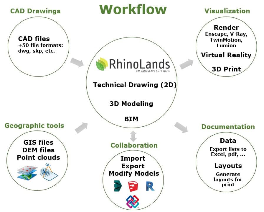
Choose the setup that best matches your workflow, whether you need a complete standalone landscape solution or a plugin for existing CAD environments.
A complete software solution that does not require another external program to begin using RhinoLands.
Ideal for users who already work in AutoCAD, Civil 3D or Rhino and want to extend their workflow with advanced landscape tools.
Join this session to explore how RhinoLands supports complete landscape design workflows for drafting, 3D development and project documentation.
Register for Webinar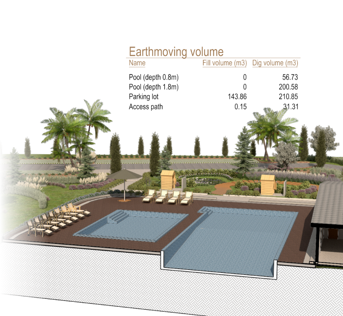
Powerful tools to support landscape planning, BIM documentation, visualization and automation from concept to delivery.
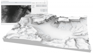
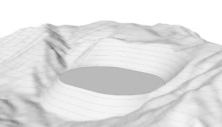
Create terrains from contours, elevation curves and point clouds, then edit cuts, fills, pits and land movements with precision.
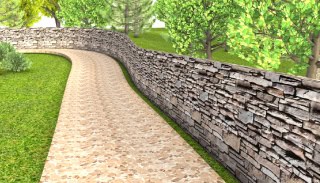
Use smart landscape and civil elements that stay editable, quantifiable and connected to your overall project documentation.
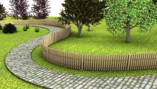
Access a rich plant library with species data, visual modes, seasonal behavior and ready-to-use output for scheduling and rendering.
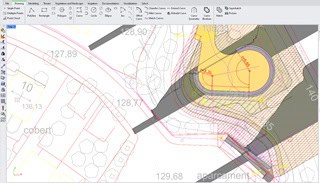
Generate plans, dimensions, labels, schedules and layout outputs from your 3D model for clearer project communication.
Automate workflows with Grasshopper for Rhino, reduce repetitive work and test multiple landscape design options faster.
Create walk-throughs, animation-ready scenes, sunlight studies and image outputs using tools like Lumion, Enscape or V-Ray.
Explore how Lands Design supports terrain, planting, documentation, hardscape and landscape visualization in one integrated environment.
This section can also be replaced later with a custom local video, YouTube embed or webinar replay if you prefer.
Designed to support multiple sectors where landscape data, terrain and environmental context matter.
Create landscape projects at multiple scales with tools for 2D layouts, 3D development, planting and presentation-ready outputs.
Plan green roofs, urban vegetation systems and natural interventions that integrate with architectural and civil workflows.
Use terrain, vegetation and irrigation tools for simulation, seasonal visualization and environmentally informed design.
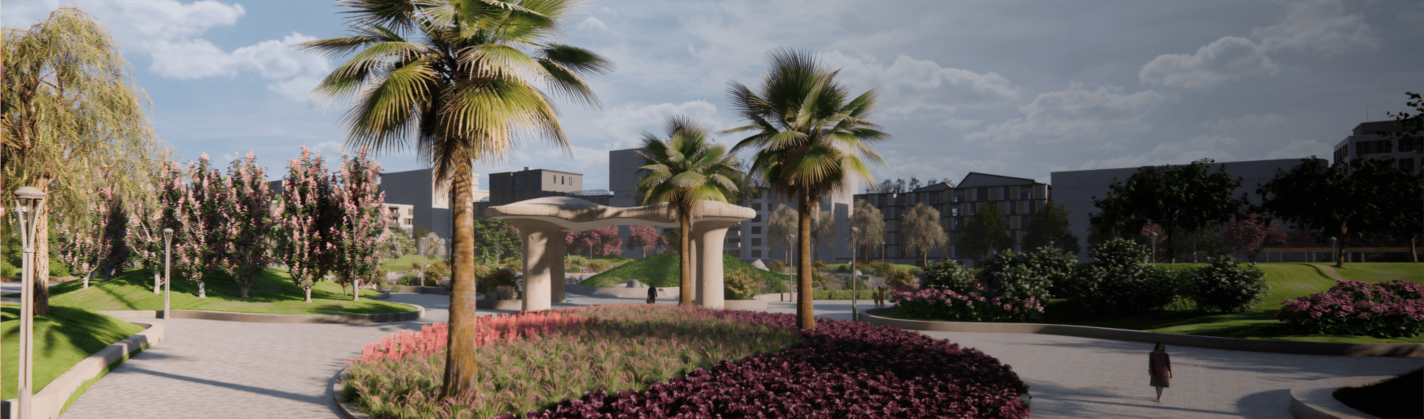
Design parks, public areas and green urban systems with better visualization, plant selection and long-term planning support.
Build natural environments, 3D assets and contextual scenes for visualization, animation, games and digital presentation workflows.
Produce coordinated technical layouts, quantity take-offs, planting schedules and design communication outputs with greater speed.
Speak with our team to learn more about Lands Design, RhinoLands, licensing, demos, webinars and implementation support.